There is a place in Northwest Jersey that will grab and hold you in its serenity — a place where humans live in peaceful appreciation of the earth. You will feel it as you drive along the twenty-three-mile stretch of the Western Highlands Scenic Byway. The Byway reveals scenic, historic, archaeological, cultural and natural intrinsic qualities of the Vernon and Highlands area. There are two parts to this scenic puzzle: a straight line from Route 23 to Warwick, New York, and an adjacent loop in Vernon.
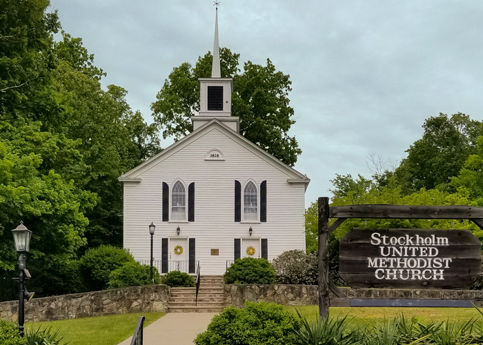
From Route 23 take Route 515 North. Shortly, on the right, the first historic site appears: the Stockholm United Methodist Church, built in 1826. Once a stop on the railroad, Stockholm was a thriving town in the late 1800s, according to Pastor Wally, until the City of Newark purchased the land, reservoirs and equipment for use of the Pequannock Watershed. A hotel and most of the houses were torn down so they wouldn’t pollute the water. Their foundations remain in the woods. In the white church, its pillars were hand-turned on a lathe, and, in the 1940s, stained glass replaced clear windows. Trees were planted on the bare property. The church is always open, so stop for a visit. Beyond the church, a tiny village of tidy homes with pretty gardens comprise the town of Stockholm.
The two-lane road winds through woodland for about six miles. At mile six, you will see a sign on the left for Hamburg Mountain Wildlife Management Area. The dirt road is rough but walkable if you want to bushwhack. Or you may want to catch the trail (after you’ve done the whole Byway) at the signed parking lot on Route 23N about 3.6 miles west of Route 517. On the right, a soft trail climbs uphill past giant boulders through a healthy, rejuvenating woodland. A garden of ferns, young hickory, hemlock, and witch hazel, and blooming viburnum and mountain laurel cover the ground. Trails abound there.
Back on Route 515, pass a residential stretch. Highland Lakes Road on the right leads to several lakes and a great stop for lunch at the Highlands General Store which, itself, should be listed as historic. Meet Ron Dupont, local historian and author.
Arrive soon in Vernon, where Route 94 N joins Route 515 and passes through fast food and strip malls, scenic barns, and the Appalachian Trail crossing from flat idyllic farmland on the left to a steep but glorious climb up Wawayanda Mountain to the State Park. You might want to park in the small lot on the right and stretch your legs on the trail, either way. Treat yourself to a hot dog or other quick bite.
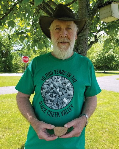
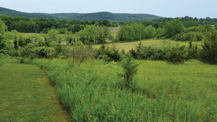
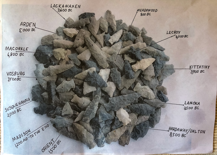
Turn around and take Route 94 S and turn right onto Vernon Crossing Road (Route 644). Immerse yourself in the serenity of vibrant greens and pale tans of protected marshes, lazy summer pastures, tended lawns — a place you will want to be. Take your first detour for an essential visit to the Historic Black Creek Site. At the “T”, turn right onto McAfee - Glenwood Road (Route 517 South). Soon, turn right onto Maple Grange Road, then right into Maple Grange Community Park. Just across the park road from the ball fields, enter a wildflower meadow with a sign at its entrance. The forty-acre Black Creek site embodies ten to twelve thousand years of Native American life where the Lenape made their home in this two-by-six-mile stretch of the great Central Valley of the Appalachian Mountains. It was here at the valley’s narrow choke point between Wawayanda Mountain and the Kittatinny Ridge that the Lenape camped, hunted, fished, and became the central hub of the Lenape Nation. Here, fourteen thousand years ago, melting glaciers left a twenty-one-mile-long lake that attracted great migrations of ducks, geese and caribou while mastodons and other megafauna inhabited the surrounding mountains. Paleo Indians, hunters of mastodon, made flint points with a notch in the bottom to attach to spears for hunting. By 3,000 BC, point styles changed to attach to a more accurate, deadly throwing stick (atlatl), and by 900 AD the bow was in use. This progression enabled field archaeologist Rick Patterson to identify the span of time the Lenape lived there. They slept and sheltered in caves formed in rock outcrops above the confluence of Wawayanda Creek and the Black Creek. The rich land, streams, and abundance of natural resources spurred population growth of the Lenape Nation. Take a walk along the and the maintained grassy trails through the meadow where the village once was and discover some of the splendor yourself.
The identification and preservation of the Black Creek cultural site was much the effort of Patterson, who put the valley’s topography and his acquired knowledge of the Lenape together. For ten years he searched the site, researched thousands of artifacts, nominated the site to be saved, and even went to court. By 2004, it was listed on the New Jersey and National Registers of Historic Places. “The detailed piece plotting of the artifacts found on the surface saved the Black Creek site,” Patterson says. And if the artifacts hadn’t been found? “It would have been fields, bleachers, a club house. It would have turned into a total destruction of the site.”
Black Creek Historic Site is not to be missed. But beware the interpretive signage with questionable information (not Patterson’s doing). For instance, although portrayed on the sign, there is no evidence that the Lenape played lacrosse. The medicinal herbs, chamomile (Europe) and Dong quai (China), were not yet here. Neither were moose. The Lenape wore moccasins they made from the hides of elk and deer; they didn’t go barefoot. In winter, Paleo Indians (8500 – 9000 BC) wore heavy fur boots and parkas made from their bounty. By 2500 BC they wore leggings, although signage depicts them as practically naked in the snow. Other errors exist. For additional and correct information, contact the Friends of Wawayanda State Park.
Turn left onto Maple Grange Road and, if you’re still hungry or want to visit another fine country store, turn right onto Route 517 N for a short distance to Pochuck Valley Farms Market and Deli with homemade everything. Filled up? Turn back onto McAfee - Glenwood Rd (Route 517 S). Revel in residential properties with grand giant maples, oaks, spruce and waterfalls of weeping willow — a majestic community of trees. This beautiful drive will warm your heart. Tired of peace and charm? Turn left onto McAfee – Vernon Rd./ Route 94 N to complete the loop. Here you will find all the fun, games, edibles and entertainment you can feast on: golf, water sports, horseback riding and more. The Western Highlands Scenic Byway has it all.
The Western Highlands Scenic Byway was officially designated by the Department of Transportation (NJDOT) in 2014 as the eighth scenic byway in the state. Three other transportation corridors that have outstanding scenic, natural, recreational, cultural, historic or archaeological significance have been designated in the Skylands: Delaware River, Warren Heritage, and Millstone Valley. The New Jersey Scenic Byways Program began as part of a larger national program that was established in 1991 by Congress under the management of the Federal Highway Administration. The program was created as a voluntary, community based, grassroots initiative to promote the recognition and enjoyment of America’s memorable roads. The NJDOT leads the program, connecting and supporting various interest groups, providing a framework for communities to create a management strategy and to develop plans that balance development, conservation, tourism and economic vitality.
For more information: Friends of Wawayanda State Park: 973-764-8554
Vernon Township Historical Society
Peters Valley shares the experience of the American Craft Movement with interactive learning through a series of workshops. A shop and gallery showcases the contemporary craft of residents and other talented artists at the Crafts Center... ceramics, glass, jewelry, wood and more in a beautiful natural setting. Open year round.
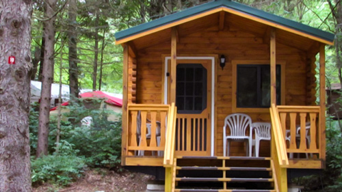
Located in Sussex County near the Kittatinny Mountains the camping resort offers park model, cabin and luxury tent rentals as well as trailer or tent campsites with water, electric and cable TV hookups on 200 scenic acres.
Follow the tiny but mighty Wallkill River on its 88.3-mile journey north through eastern Sussex County into New York State.
“The Fluorescent Mineral Capitol of the World" Fluorescent, local & worldwide minerals, fossils, artifacts, two-level mine replica.