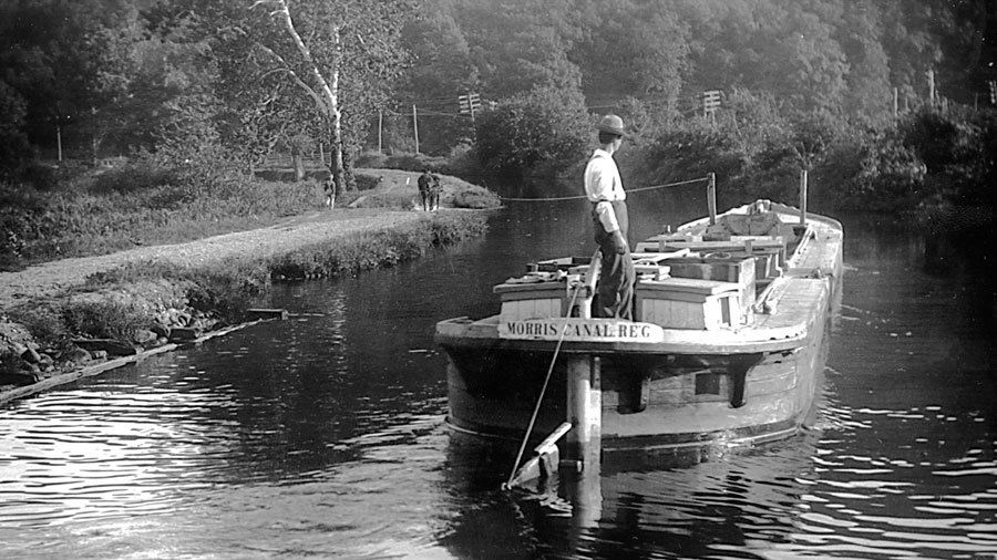
The Morris Canal always was a good place for a stroll. The canal's 102-mile meander across northern New Jersey, from Phillipsburg to Jersey City, was walked by every mule driver for every team that pulled a canal boat from 1831 to 1924. Today's Morris Canal Greenway encompasses part of the historic Morris Canal's alignment and is a cooperative effort of the New Jersey Division of Parks and Forestry, the Canal Society of New Jersey, Waterloo Village and Friends of the Morris Canal. The Greenway's purpose is to preserve the remains of the Morris Canal and its associated natural environment, to interpret canal sites to the public, and to offer recreational opportunities. As you walk the Greenway you will see the remains of canal features, including inclined planes, locks, canal bed, and historic industries and communities directly related to the Morris Canal's operations.
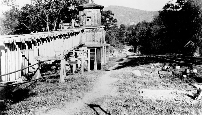
The Morris Canal was the brainchild of Morristown businessman George Macculloch, who envisioned a commerce route that could surmount North Jersey's rugged terrain to ship coal, iron ore, farm produce and other products across the state. To conquer an unprecedented 1,674-foot change in elevation - 760 feet from the Delaware River at Phillipsburg up to Lake Hopatcong, the summit level, and 914 feet back down to tidewater at Newark Bay - the Morris Canal used a series of locks and a new innovation, the inclined plane. Operated from 1831 to 1924, the Morris Canal was considered an engineering marvel of its time, but, by the end of its life, it had been surpassed by railroads as a shipping route. Although employed on a smaller scale on English canals, the inclined plane was adapted for the Morris Canal and used to conquer changes of elevation anywhere from 35 feet to 100 feet. The canal boats were floated onto a cradle car, which was pulled out of the water, then up or down on iron rails to the next section of canal. Those iron rails were supported by heavy stone sleepers, which on several of the planes can still be seen, often with a groove worn into them by the thick cable that raised and lowered the cradle car.
Boats nearly ninety feet long and capable of carrying seventy tons of cargo transported coal from Pennsylvania—the canal’s lifeblood—along with other products such as building supplies, household perishables, firewood and manure— even sawdust from canalside mills for delivery to icehouses that in turn shipped out blocks of ice. The boats were built in two sections hinged together to facilitate entering and leaving the canal’s system of locks and steep inclined planes, an innovation that allowed the boats to conquer an unprecedented 1,674-foot change in elevation along its route.
Boat captains, ranging from fathers and husbands to teenagers, steered the boats while mule tenders—often the captain’s children or wife—kept teams moving along the towpath, pulling the load from lock to lock.
However, the canal's towpath also served as a route for recreational rambles during its years of operation. I was fortunate to visit the noted Morris Canal historian, James Lee, before he passed away a few years ago. "People did a lot of walking on that canal. I've got pictures of ladies walking along the canal with their white dresses on,'' he told me, describing how they carried umbrellas for shade as their long dresses trailed down to their ankles in the fashion of the day.
The canal's role as a place for pleasure jaunts continues to this day, with a number of partners involved in turning portions of the canal into recreational paths. One such effort is the Morris Canal Greenway project, a joint endeavor by the New Jersey Division of Parks and Forestry, the Canal Society of New Jersey, Friends of the Morris Canal and Waterloo Village. The County of Warren and many municipalities along the canal's route also have been involved in preserving remaining sections of the canal, turning them into linear parks so people can learn about the canal and enjoy spending time along its route.
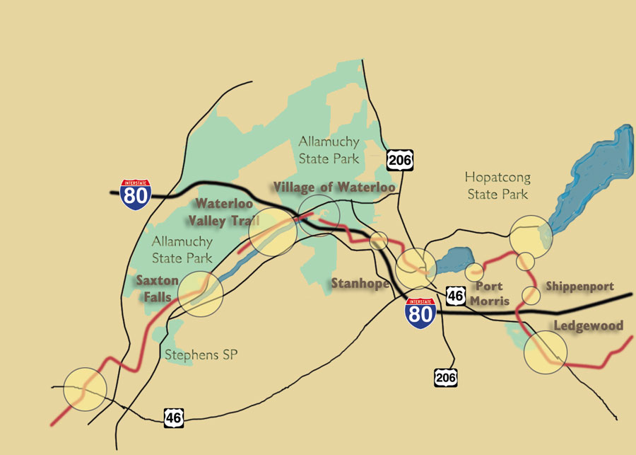
We'll start with a look at the canal from Ledgewood in Morris County's Roxbury Township, through the corner of Sussex County where the canal traveled in Byram and Stanhope, and on to Saxton Falls in Warren County.
Brian Morrell, former vice president of the Canal Society of New Jersey, is one of the many volunteers who has helped to clear the towpath of brush and identify historic features that remain in order to create a walking path on the Morris Canal Greenway. "We have grandiose dreams. The ideal would be the whole 102 miles of the canal,'' Morrell said of the Canal Society's efforts.
The initial focus of the society, a 1,300-member organization, has been in the Ledgewood to Saxton Falls area, where large sections of the canal remain intact and where much of it is publicly owned. By establishing a public path along the canal route in that area, the canal society has built an advocacy group of people who use the towpath for recreation, and spread the preservation project both eastward and westward.
Lee, whose often reprinted 1973 book The Morris Canal, A Photographic History and his 1977 history, Tales the Boatmen Told have done much over the years to draw attention to the canal, endorsed the Morris Canal Greenway concept. "I think that's a good idea,'' Lee said, noting it will get people interested in the canal and its history.
While volunteers have spent hundreds of hours in the past several years clearing debris from the canal towpath to create a continuous recreational and historical trail, the state has been buying property to expand the sections of the canal in public ownership. Moreover, State Parks and Forestry staff constructed a timber footbridge to carry the path over a former canal waste gate, a short distance west of Waterloo Village, and interpretive signage is to be erected this spring along the canal near Waterloo. Funded through a grant from the Intermodal Surface Transportation Efficiency Act (ISTEA) and the New Jersey Department of Transportation, the signs include historic photographs, stories, and information about the canal, how it operated, and the lives of the canal workers and businessmen who helped in its creation and success.
A good spot to see features that remain from the canal is in Ledgewood, at Roxbury Township's municipal Canal Park. Located just off Main Street, near the intersection of Routes 46 and 10 at the former Ledgewood Circle, the park includes the remnants of Inclined Planes 2 and 3 East, a long stretch of dry canal prism and a canal basin that still contains water. The canal boats waited in this basin to go up or down the planes.
The Roxbury Township Rotary Club has been restoring the planes, as well as King's Store, which was built in 1815 and served for many years as a canal store. Also located there is the Silas Riggs Salt Box House, which is the headquarters of Roxbury's historical society and operated as a museum.
Heading west, the next major area of interest is Hopatcong State Park at the outlet of Lake Hopatcong. This impoundment, New Jersey's largest, was created from two smaller lakes to be the major water supply for the Morris Canal at its summit level. The dam now in existence was built at the closing of the canal to replace the former dam, and it includes part of the wall of a lock. "You can see the old stonework below,'' Morrell notes.
The towpath is open for walks along a section of the feeder canal that led from the lake to the Morris Canal's Eastern Division, which headed for Newark and Jersey City, and its Western Division, toward Phillipsburg.
Also located at Hopatcong State Park is the Scotch reaction turbine that powered Plane 3 East at Ledgewood, which was moved there for display after the canal closed. "It's the most intact one you can see anywhere,'' according to Morrell, who explains the massive turbine "operated on the same principal as a giant revolving lawn sprinkler.''
At each plane, water from the canal's upper level flowed into the headrace flume to the powerhouse, where it dropped 40 to 50 feet to the turbine. The force of a five-foot diameter column of water dropping that distance, flowing up through the turbine and shooting out of its curved arms, made the turbine spin, powering the cable that pulled the cradle car holding the canal boat on the plane. "This one is so big, you can walk inside the bottom of it,'' Morrell says of the turbine.
Hopatcong State Park includes the Lake Hopatcong Historical Museum in a former lock tender's house. Started by the Hopatcong Historical Society, the museum contains information on the canal as well as the resort hotels that used to line the lakeshore and the famous people who used to summer there, including movie stars and presidents. Beginning in early spring, the museum is open 12-4 p.m. Sundays through mid-June, and again from mid-September through November. More information about the museum is available by calling 973-398-2616.
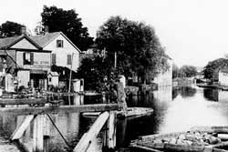
Stanhope, located in the southern end Sussex County on the Morris County border, is full of features from the Morris Canal. Lake Musconetcong was built as a canal reservoir and the canal crossed the lake with the towpath located on a raised earthen causeway, which is now only visible when the lake is periodically lowered. A stroll through Stanhope starts at Lakeside Park at the lake's dam near Route 183 and Main Street, where the top of the walls of Lock 1 West are visible although the lock has long since been filled in. "It gives an excellent opportunity to see the size of a canal lock,'' Morrell explained and consequently to get an idea for the size of a canal boat.
Proceeding across Route 183, there is a short section of canal with water in it, leading to a series of buildings that were canal stores and depots. The Stanhope House at the corner of Main and High streets was a stagecoach and canal stop. Canalers would tie up their boats in a basin nearby "and you could walk right across the street into the bar. I imagine it was a pretty hopping place, and it's still a hopping place,'' Morrell remarked, noting the Stanhope House - where Babe Ruth was a visitor - is now a well-known blues club.
While some who worked on the canal were rough and tumble types who would frequent taverns along the way, other boats contained whole families. "It was a mix,'' Morrell noted. On those family boats, the parents would steer while the children would guide the mules on the towpath.
Stanhope was the location of the Musconetcong Ironworks, which used the canal to bring in coal and ore and ship out the finished product. Inclined Plane 2 West ran between Plane Street and Plane View Street, where the stone block sleepers that supported the plane's rails are visible. Morrell notes that a walk along Plane Street gives a good idea of the height and slope of the canal plane. Near the foot of the plane is the foundation of a mule stable where canal mules were housed at night.
According to Lee, the condition of his team of mules reflected on a canal boat captain. When the team was in poor condition, the boat would not make good time in its journey between Phillipsburg and Jersey City, which took an average of five days. Lee said the mules - or horses, which also were used - would walk and tow the boat sometimes until 9 or 10 at night, often until reaching a lock or inclined plane where the captain would tie up for the night. The team would be brought to a barn and given fresh hay. While most teams consisted of two animals, Lee noted that occasionally three mules were used.
"You'd make better time. Maybe you could make the trip in four days'' instead of five, he says, and more trips meant more pay. Also, a larger team could pull a heavier load, increasing the captain's pay per trip.
At the foot of plane, the towpath crossed the Musconetcong River on a concrete bridge, where a half-mile stretch of the towpath is open for walks along a section of canal that has water in it. Morrell says this section of canal, owned by the state and located in Mount Olive, is "one of the best preserved in the state.'' The only major difference from when the canal was in operation is that a row of trees and brush has grown between the towpath and the canal. But Morrell notes canal restoration proponents are hoping to someday remove that vegetation and return the area to what it looked like a century or more ago.
"Because so much of the Morris Canal has been destroyed or radically altered, it's a pretty special experience if you're interested in the Morris Canal'' to walk along that section, Morrell enthused. Unlike strolling a dry section of the canal prism, "it gives a whole different impression of what it was like.''
Not far from Stanhope is Waterloo Village, an historic hamlet that dates to Colonial days but saw its heyday during the canal era. Now part of Allamuchy Mountain State Park, Waterloo Village provides occasional access to a number of canal features and the Canal Society of New Jersey's museum.
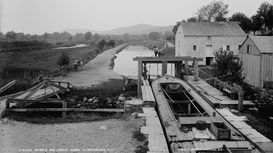
"It's about as picturesque as you can get,'' Morrell says of the village, noting the canal lock, inclined plane site, canal store and other buildings give a real sense of Waterloo's role as a canal port. At Smith's Canal Store, built in 1831 along the canal, boats could dock and unload goods directly into the building. The store is open and food is served in the lower level, giving visitors a chance to dine along the canal.
In his 1996 Guide to the Morris Canal in Morris County, author Joseph J. Macasek includes a section on Waterloo Village and notes that a "serene atmosphere is preserved'' in the village's restoration. "But to envision its days as a busy canal town you must see in your mind's eye a canal crowded with boats waiting to pass the lock and ascend the inclined plane, trains of ore cars from the mines dumping their loads at the ore dock and boatmen, trainmen and farmers gathering at Smith's Store for food and conversation.''
The Canal Society's museum includes artifacts, diagrams, models of a canal boat, lock and inclined plane, photos and a video on the Morris Canal, according to Morrell and Dave Detrick. The museum also contains displays on the Delaware & Raritan Canal in central New Jersey. Detrick is a Canal Society member who also chairs the Warren County Morris Canal Committee, a group under the Warren County Planning Department that has been working on that county's long-range plan to acquire, preserve and develop recreational facilities at sections of the canal. According to Detrick, visitors to Waterloo can walk across a replica of the mule bridge that traversed the Musconetcong River to the foot of Inclined Plane 4 West. The sleepers that held the plane's rails, the foundation of the powerhouse and plane tender's house, and a length of the plane's cable all are visible in this area.
Waterloo also has the distinction of being the spot where three years ago, the Canal Society put a boat on a watered section of canal and used mules to tow it. This marked the first time in some 74 years that mule and boat were reunited for a trip on part of the Morris Canal. Waterloo Village also is the location for the Canal Society's annual Canal Day, held each year in late spring.
Continuing to the west are further sections of the Morris Canal Greenway trail, leading to a largely abandoned hamlet that was known by names that included Byram, Stourport and Starport. There are sections of towpath cleared here along the canal, which frequently contains water. Remnants of those bygone days include ruins of buildings, a stone abutment for a bridge that crossed the canal, and stonework that supported the canal embankment.
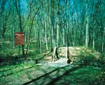
Another section of the greenway trail is accessible from Kinney Road, off Waterloo Road and near Waterloo Village's large concert field. Visible here is a waste gate that allowed water from a stream entering one side of the canal to discharge out the other side. The gate also could be used to completely drain that section of canal for repairs. Proceed west for about a half-mile as the canal skirts the concert field, offering scenic views of the Musconetcong River. The trail runs along Waterloo Road for a short distance and then to another historic industrial area, where a stream flowing from Deer Park Pond once powered a sawmill. Ruins of the sawmill remain, as does a lime kiln next to it. Morrell says an iron ore dock on the canal also existed in this area.
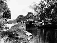
Nearby is the site of Lock 4 West, and the lock tender's house, now owned by the state, was once known as Elsie's Tavern. Morrell said the Canal Society is hoping to get this building restored.
A tour of this section of the Morris Canal ends at Saxton Falls, where a dam was constructed so that the Musconetcong River could be used as a slack water navigation section of the canal. According to Morrell, the Saxton Falls area was at one time known as "Little Phillipsburg,'' because so many people from Phillipsburg had bungalows there. The bungalow community existed until about 15 years ago, but many of those properties were purchased by the state for a reservoir that was never built. Through the greenway project, "We're really opening up that area to people again,'' Morrell remarked.
Saxton Falls includes another lock that has been filled, but the top of its stone walls is visible, again giving the visitor a sense for the size of a Morris Canal lock. Morrell said the Canal Society would like to see a boat ride along Saxton Lake someday. Also at Saxton Falls is a commemorative plaque regarding the canal, and a cleared section of towpath stretching more than a half-mile.
Warren County has been an active partner by promoting a greenway corridor and preserving the historic remains of the Canal as an important part of the County's transportation history. The vision is to have this greenway extend across Warren County with the canal as a link to recreational, cultural, and historic areas including state parks and trails, plus municipal and county public open space. This greenway will extend between canal sites in Phillipsburg and the historic Waterloo Village a restored canal town. The canal travels through the scenic Musconetcong, Pohatcong and Lopatcong valleys for thirty-three miles from Phillipsburg, on the west, to the county line near Waterloo on the east. This heritage corridor gives reminders of its glory days; inland ports of call with names like Port Colden, Port Murray, Port Warren, Port Washington, Rock- port and descriptive identities, such as Fresh Bread Lock, Guinea Hollow, and Greene's Bridge.
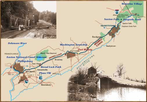
To view sections of the canal, the visitor would do well to bring along Macasek's book, which was published by the Morris County Heritage Commission. Detrick also suggests bringing a copy of James Lee's photographic history, as many of the structures in the vintage photos are still apparent today. Meanwhile, Detrick says a 1987 study by Morrell, Historic Preservation Survey of the Morris Canal in Warren County, New Jersey, is another useful resource for people who want to explore remains of the canal from Phillipsburg to Allamuchy on the Sussex County border. The survey is available from the Warren County Planning Department (908-475-6532) at a cost of $30.
More about the Morris Canal Greenway...
Follow the tiny but mighty Wallkill River on its 88.3-mile journey north through eastern Sussex County into New York State.
Consider Rutherfurd Hall as refuge and sanctuary in similar ways now, as it served a distinguished family a hundred years ago.
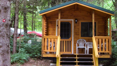
Located in Sussex County near the Kittatinny Mountains the camping resort offers park model, cabin and luxury tent rentals as well as trailer or tent campsites with water, electric and cable TV hookups on 200 scenic acres.
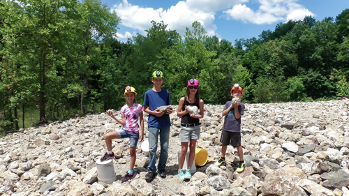
“The Fluorescent Mineral Capitol of the World" Fluorescent, local & worldwide minerals, fossils, artifacts, two-level mine replica.
The Centenary Stage Company produces professional equity theatre and also a wide variety of top-flight musical and dance events throughout the year.