Mapmakers have included Schooley’s Mountain, once called Schugyl’s Hill, since at least the 1830s. Running northeast for twenty miles from Glen Gardner to Lake Hopatcong, the mountain’s steep sides rise to a broad top between the Musconetcong River and, for most of its length, the South Branch of the Raritan. The mountain presents a dichotomy of striking scenes from the past, interspersed with groups of modern homes and stores. Heavily traveled periphery highways are connected by a web of narrow, shoulderless rural roads that still meander as they did when “horse power” meant just that. The mountain’s southern portion holds routes worthy of exploring, hamlets for artists to ponder, and natural areas for hikers, all shrouded in tantalizing lore that begs a historian’s query.
South of Washington Borough, a large rocky projection extends upward on Schooley’s, labeled on the earliest maps as Squire’s Point, now known as Point Mountain. From Route 31 south of Washington, turn east onto Musconetcong River Road, following it past the vintage homes and former shops of the old village of New Hampton, where a quaint old stone church houses the Lebanon Township Museum. Pass through Changewater, where an early forge placed the ancient hamlet on a 1777 map, and where the impressive ruins of an old railroad trestle over the Musconetcong evoke the days when the river powered a grist mill, tannery, and factories in the 1800s. The notorious 1843 Castner murders, motivated by the greed of neighbors and kin, occurred near here, the murderers graves still marked by two stones just a few feet off McCullough Road a half mile away.
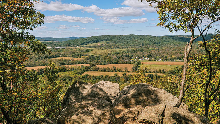
About two-and-a-half miles from Changewater, just before Musconetcong River Road crosses its namesake, a small parking area provides access to the Point Mountain Reservation trail network, adapted from old logging roads by Hunterdon County’s Parks Division. You can hike the scenic Riverwalk, among old stone rows and once-cleared pastures along the Field Trail, or to the Overlook that reveals the splendid Musconetcong valley beyond.
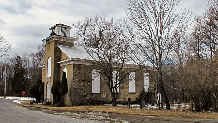
A short distance across the river in the village of Anderson, another notorious murder took place in 1859, when Jacob Harden, a young minister, served a poisoned apple to his new bride, the former Hannah Dorland. He was hanged in 1860. Follow Point Mountain Road up the mountain to the intersection with Mount Lebanon Road where Reverend Harden once served his congregation at the Mount Lebanon M.E. Church.
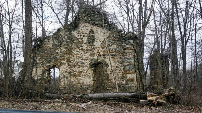
Half a mile ahead, at the hamlet of Anthony, Mount Lebanon Road meets Anthony Road. Turning right leads to the ruins of the Swack church, built in 1844 by a mason named Swackhammer, and abandoned in 1896. Backtrack on Anthony Road to a right on Sliker Road, then a left onto Pleasant Grove Road to two other Hunterdon County parks. Down the road on the left is the entrance to Crystal Springs Preserve, whose name reflects the area’s chalybeate ground waters that are high in iron and other minerals beneficial to human health. The springs are also headwaters for the Spruce Run, which in turn feeds the reservoir north of Clinton. Trails within the preserve skirt active farmland, through meadows and woods, past ponds that attract herons, migratory waterfowl, and beavers.
On Pleasant Grove Road’s south side, Teetertown Preserve offers trails through high, wide-open fields with scenic distant views, hilly wooded areas. The Mountain Farm section of Teetertown Preserve, owned and worked by the Lantz family from 1749 to 1926, was later used by the Watchtower Bible & Tract Society (Jehovah Witnesses) as a farming commune until Hunterdon County Parks acquired it in 1999.
The actual old hamlet of Teetertown is further down Sliker Road, then a left on Teetertown Road leads to a small vale where John Teeter bought a pre-Revolutionary gristmill in 1814 that he operated until his son-in-law Samuel Dorland took over, operating it for sixty years more. That’s the same Dorland whose daughter was slain by the malicious Rev. Jacob Harden. The mill was dismantled in 2001 and moved to central Texas where it once again grinds grain. Another vintage Teetertown house was once the weekend home of Merv Griffin, the TV celebrity.
From Teetertown, Hollow Brook Road winds upward through the deep Teetertown Ravine at the eastern edge of the preserve. In 1896, the Middle Valley Trap Rock Company started a quarry here, crushing 400 tons of rock daily before closing in 1923. Driving up the ravine is not for the faint of heart. The very narrow rocky road leads through one of New Jersey’s “most significant natural areas”. Scant parking allows access to a few park trails including an interpretive Geology Trail. Be prepared and don’t panic if you meet another vehicle coming your way!
Sandwiched between what would become today’s Teetertown and Crystal Springs Preserves, former Camp WoChiCa, (Workers’ Children’s Camp), operated from 1934 to 1954. Sponsored by the International Workers Order, linked to the Communist Party USA, the camp was an idyllic respite for the thousands of young children of all races and nationalities, mostly from the impoverished streets of New York. Paul Robeson was the camp’s great champion and visited often, along with other contemporary celebrities of the left, such as Pete Seeger and Woody Guthrie. The camp was inevitably doomed by a potent dose of McCarthyism.
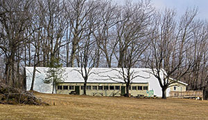
Loop back to Sliker Road down to Route 513 and head east five miles to Long Valley. Fairview Avenue passes by the Washington Township Historical Museum located in an 1830 stone schoolhouse next to the ruins of the Old Stone Union Church. Less than a mile farther is a parking area at the southern edge of former YMCA Camp Washington, now Morris County’s Schooley’s Mountain Park. Park trails here—with intriguing names such as Boulder Gorge, Falling Waters, and the Quarry Trail—lead hikers to ruins of the first electric plant in Washington Township, a beautiful cascade in the Electric Brook, overlooking on outcroppings near an old quarry. (trail map, .pdf) The Columbia Trail and Patriot’s Path networks can also be accessed here.
In Long Valley, Schooley’s Mountain Road traces the route of the old 1810 Washington Turnpike, aka Morristown-Easton Turnpike, as it climbs steeply up to the mountaintop village of Schooley’s Mountain, where the turnpike split. A spur of the old turnpike, today’s Route 24, went down the mountain to Hackettstown, while today’s Pleasant Grove Road traces the turnpike’s main route across the mountain before descending to Penwell at State Route 57.
Stagecoaches used the Washington Turnpike for decades before the earliest automobiles appeared. In 1903, Thomas Edison raced his high-powered touring car up Schooley’s Mountain Road, trying to beat a train to New Village… he won. And four years later the Jersey Hill Climb was scheduled up the same road, featuring its steepness and dangerous S-turn in a very challenging course. In the first half of the hairpin, Camp Washington Road on the right leads to Schooley’s Mountain Park’s main parking area, a lake with a floating bridge, picnicking, and trailheads.
American Indians knew about the Spring’s healing powers, but it took European settlers to develop the magical water into a business.
Shortly after the Revolutionary War ended, the mountain’s inhabitants searched futilely for gold and other valuables that they believed vanquished Tories hid before fleeing. But the real treasure in the mountain was pure chalybeate mineral water, valued for its curative powers. The famous Schooley’s Mountain Spring appears even on the earliest maps beside the old turnpike spur near the base of the mountain. American Indians knew about the Spring’s healing powers, but it took European settlers to develop magical water into a business. In 1770, Muhlenberg, founder of the Lutheran Church in America, visited the spring and wrote in his diary that the waters of the “newly discovered health spring” flowed into an “artificially constructed hole”.

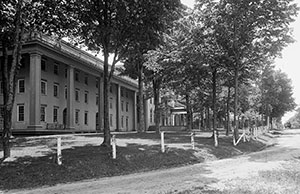
The Spring’s earliest visitors found only sparse accommodations, living in tents or wooden shacks during their stay. After the Washington Turnpike increased accessibility to the mountain resort, boarding houses were built in the early 1800s, as were two large hotels—Heath House and Belmont Hall—that offered tourists luxurious lodging and meals, plenty of activities, and, of course, access to the Spring’s outlet nearly a mile down the mountain, sheltered by a “most splendid summerhouse” resembling a Greek temple. In the later 1800s a tall Victorian-style gazebo with a fountain in the middle served the purpose. Schooley’s Mountain resorts became the place to be for socially conscious urbanites of New York, Philadelphia, and even Washington. Claims are made that guests included Vanderbilts, Astors, Roosevelts, President Ulysses S. Grant, President Benjamin Harrison and even Thomas Edison. At first, rail travel buttressed the tourist trade at Schooley’s, but railroads also made it easy to get to the Delaware Water Gap and the Poconos, Saratoga, Newport, and Long Branch, NJ. By the 1930s the big hotels had both disappeared. Even the Spring is gone now, altered forever by a mid-1900s road project which changed the course of the water beneath the mountain.
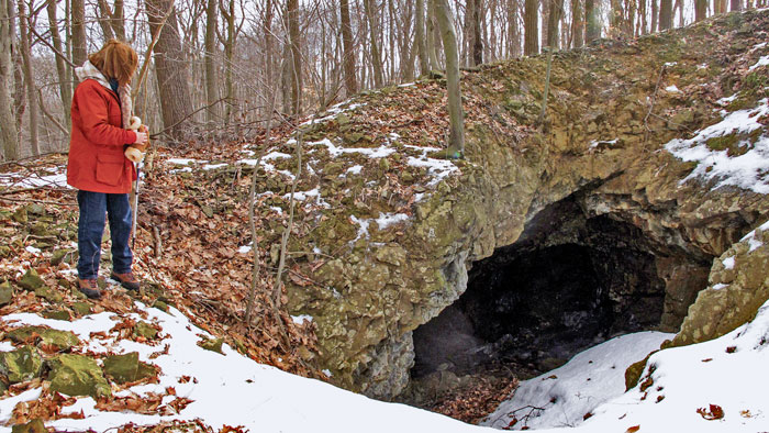
The mountain’s iron not only made for rich water; there were abundant iron ore workings in the mid-1800s. Most were just exploratory pits, producing very little ore. However, the Marsh mine, located up Schooley’s Mountain Road from the famous mineral spring, was more productive. Near Marsh’s two large pits was the smaller Dickinson mine (1855) and Young’s mine across the road. It was said that the magnetizing effect of the Marsh ore was so powerful that miners had difficulty removing their iron mallets from their other mining tools after striking them. One miner claimed to have lifted a hundred pounds of iron tools stuck to his mallet! Trails in Cataract Park, along Route 24, lead up to one of the mines once worked here and the cataracts once visited by tourists of another era.
Iron workings of various magnitudes developed also along the present-day Pleasant Grove Road, as it heads west out of the village of Schooley’s Mountain. Across the fields near the edge of the mountain top, the Fisher mine, one of the area’s most productive, opened in 1864 and was worked extensively for a few years, producing about ten thousand tons of ore. Just a mile away, the Sharp mine yielded only fifty tons of ore before the it was abandoned in the 1870s.
Farmers often found ore—some mined, but most continued doing what generations did before the iron workings started. In 1904, an ancient plow that had been in possession of a local family for over 200 years, said to have been brought to the colonies in 1654, was claimed to be the oldest plow in America. Some say the old plow had gone beyond the call of duty; used to break up the ground for construction of the old turnpike leading from Hackettstown to German Valley, now Long Valley.
A turn off Pleasant Grove onto Califon Road leads a short distance to the graveyard in which the forsaken Hannah Dorland lies buried. As the old turnpike crosses the county line, it becomes Penwell Road. After passing through a large hollow in Point Mountain Reservation, it reaches the old hamlet of Penwell with a few remaining vintage structures and a mill that is still in operation.
A few miles east from Penwell on Route 57, Beattystown rests along the Musconetcong River opposite a tract of land rising from the base of the mountain, called the “English Settlement” for several English families that lived there in the early 1800s. From here, Kings Highway heads back up Schooley’s Mountain, eventually meeting the old Washington Turnpike at the top. Here, Henry Beck put forth the legend of the “marching feet”, sounds mimicking legions marching along the timeworn roads. Claims are made that long ago soldiers did indeed march nearby: Revolutionary War soldiers from 1777; three hundred men drafted for the War of 1812; even British prisoners being marched southward after a Revolutionary War defeat elsewhere. Not far away, where the old turnpike spur from Schooley’s Mountain cuts through the English Settlement tract, Washington’s troops are said to have marched on their way to Jockey Hollow after the battle of Trenton.
And there’s the story from 1778 about an American spy, disguised as a British officer, who sought refuge in a farmhouse on Schooley’s Mountain. Pursued by British troops, he was on his way to deliver a message to Gen. Washington. As the British entered the farmhouse he hid inside a quilt until he was able to escape. With all that action, perhaps there is some merit to the “marching feet” legend after all.
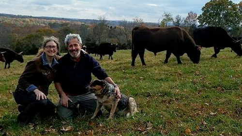
Artisanal cheeses, wood fired breads, 100% grass-fed beef, whey fed pork, and suckled veal, 100% grass-fed ice cream, pasta made with Emmer wheat and our own free-range eggs, and pesto made with our own basil! Bread and cheesemaking workshops are held on the working farm as well as weekend tours and occasional concerts.
Even today, if you needed a natural hideout—a really good one—Jonathan’s Woods could work.
Dedicated to preserving the heritage and history of the railroads of New Jersey through the restoration, preservation, interpretation and operation of historic railroad equipment and artifacts, the museum is open Sundays, April thru October.

Delightful fantasies beyond words! Gold, Platinum & Silver Jewelry, Wildlife Photos, Crystal, Lighthouses. Perfume Bottles, Santas, Witches Balls, Oil Lamps, Paperweights, Chimes, Art Glass, Wishing Stars. Also offering jewelry and watch repair