Strolling along the Paulinskill Valley Trail is a fine way to spend a summer day. With access points and parking spaces in many places along this 27-mile soft dirt-cinder path, you can stroll at leisure or pick up the pace as you wish. You can also explore off trail and discover hidden gems of nature, history and the early culture of coal, commerce and railroads. Managed by Kittatinny Valley State Park, the trail is flat, easy and comfortable for walkers, bicyclists, dog-sledders and horse-back riders.
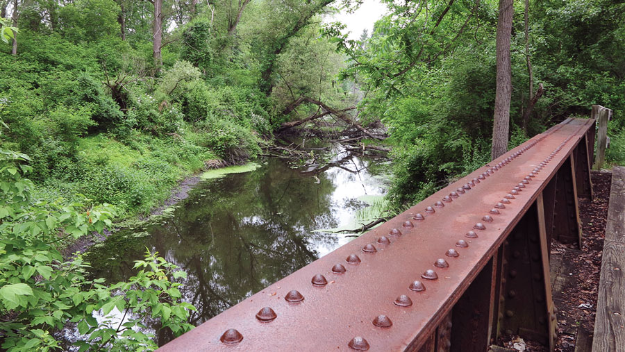
I start on the trail at Warbasse Junction in Lafayette Township, just north of the trailhead in Sparta. The path crosses a trestle bridge over the Paulinskill River where the New York, Susquehanna and Western Railroad once chugged carrying coal from eastern Pennsylvania. The river (a.k.a. Paulins Kill), which begins unceremoniously in Newton, flows to the Delaware River in Columbia. The path slides through wetlands of skunk cabbage and ferns, feathery phragmites and multi-trunked red maples, all indicative of the hydrology. Bird song rings out rich and clear, and wild flowers perfume the air making for a sensory walk in Nature.
Soon the trail intersects its sister rail-trail, the twenty-mile Sussex Branch. Heading north, the wide, cinder path is open and well-maintained with vegetation kept at a distance. Views vary: houses with gardens, farmettes with backyard horses and tractors, fields and old stone walls. Young maples regenerate in the sun. The path tunnels through a massive rock outcrop dotted with lichens, ferns and a few tenacious trees. Berms allow views from above.
Crossing Rt. 206 in Augusta, the trail leaves civilization and enters woodland. The air gets cooler on a narrower path through cathedral-like trees: red and black oaks, maple, shagbark hickory, ash. Violets, ferns and wood poppies line the path and perk the spirit. Down below in the wetlands, elderberry blooms. Intrepid cooks can make home-made syrup or wine with the blossoms. At 2.8 miles later I emerge at Rt. 519 in Balesville where daylilies greet me below the path.
From Balesville, the trail does not go near the Paulins Kill again in Sussex County, but the Sussex Branch does. I decide to hop in my car and visit the river further up Rt. 519, for nothing calms the spirit like Nature and its myriad of marvels such as ferns with new, wide flung fronds and last year’s fronds dried and brown but hanging curly like a ruffled skirt. And then there’s the swallows…
Years ago I discovered the swallows at their nesting place: a magical bridge spanning the Paulins Kill. On the bridge’s undersurface, they build nests like water-front apartments on the sides of beams. They dart and swoop in a cacophony of sound while catching insects on the fly. They make a lot of noise, these tiny, agile, spirited creatures.
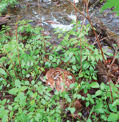
Down Route 94 in Warren County, Joanne Wojcik, treasurer of the Paulinskill Valley Trail Committee and a twenty-year member, and I turn onto Spring Valley Road, pass an old stone mill and park where the trail meets the river. On the bridge over the river, a cement block says “Warren County.” We walk north for a while, then decide to explore the southerly trail. In the woods, a small but tumbling stream makes its way to the Paulins Kill to join in its westward journey. But on a small rise in mid-stream, Joanne discovers a treasure: a day-old fawn stowed by its mother there to protect it from predators.
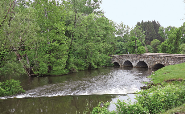
From Rt. 94, take Lincoln Laurel Road, turn left on Stillwater Road, and left on Old Stonebridge Road for a picturesque ride. Cross the Paulins Kill and park. Here, tranquil waters run wild over a dam then slide under an old stone bridge.
Just before Blairstown on Route 94, turn right onto East Crisman Road and park on the left or in the boat launch area on the right. The waterfalls are grand for such a small stream and worth the stop. Native pickerelweed surrounds the stream. Joanne has been riding horses on the Paulinskill Trail for years, especially to this favorite spot on the river where she brings her haflinger horse, Pony Boy, to wade. She tethers the bareback horse and lets him roll around in the river here.
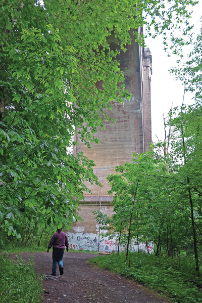
On the road again down Route 94 in Knowlton, turn left onto Station Road at the big American sycamore. Turn right and park when you see the 1,100-foot Paulinskill Viaduct. Built by the Delaware, Lackawanna, & Western Railroad in 1908, abandoned in 1979, the rails ripped up in 1985, graffiti-ridden and woodland hidden, the massive seven-arch concrete bridge right on the trail is impressive. The viaduct is owned by the state and off limits to trespassers. Heading back northeast on foot, follow the trail through wide, open woodland. It crosses the river twice on the way to the Blairstown Airport: at Polkville and West Crisman Roads and at Gwinnup Road. It also passes briefly through residential property and the airport with hitching posts for horses while you stop in for a bite.
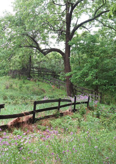
Last whistle stop off the trail: the former Old Polo Grounds a.k.a. Cedar Lake Stud Farm on Cedar Lake Road. To get there, park at Footbridge Park in Blairstown and head southeast. You will see wooden fences surrounding overgrown pasture. Walk in to the left when you see a wide, weedy farm road. The property is beautiful and almost painterly in its decline. Long indoor arenas, stalls and other buildings decorated by wild flowers and neglect; grand trees, pastures and vignettes of people’s lives moving on invoke reflection, awe and contemplation. Nature reclaims them all.
The Paulinskill Valley Trail is much more than a trail. It’s a path to discovery. Use it this summer.
Local roots!
Follow the tiny but mighty Wallkill River on its 88.3-mile journey north through eastern Sussex County into New York State.

A fine art gallery like no other! Unique, handmade gifts and cards as well as yoga, meditation, and continued learning lectures. Come in Saturdays for all-day open mic and Sundays to try unique nootropic chocolate or mushroom coffee. Browse the $5 books in the Believe Book Nook while you nibble and sip.
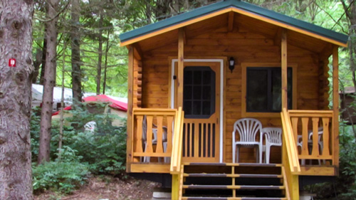
Located in Sussex County near the Kittatinny Mountains the camping resort offers park model, cabin and luxury tent rentals as well as trailer or tent campsites with water, electric and cable TV hookups on 200 scenic acres.
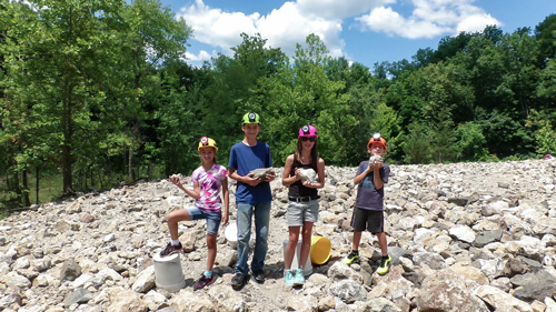
“The Fluorescent Mineral Capitol of the World" Fluorescent, local & worldwide minerals, fossils, artifacts, two-level mine replica.