Here are five Hunterdon County bike routes: Delaware & Raritan Canal State Park Towpath along the Feeder Canal, the Columbia Trail, the Round Valley Roundabout, the Last Covered Bridge Ride and the Lamington Valley River Ride. In the process of cycling the routes, I've slowly fallen in love with Hunterdon County and gained a respect for how scenic things become once you get off the main highways and away from the major population centers.
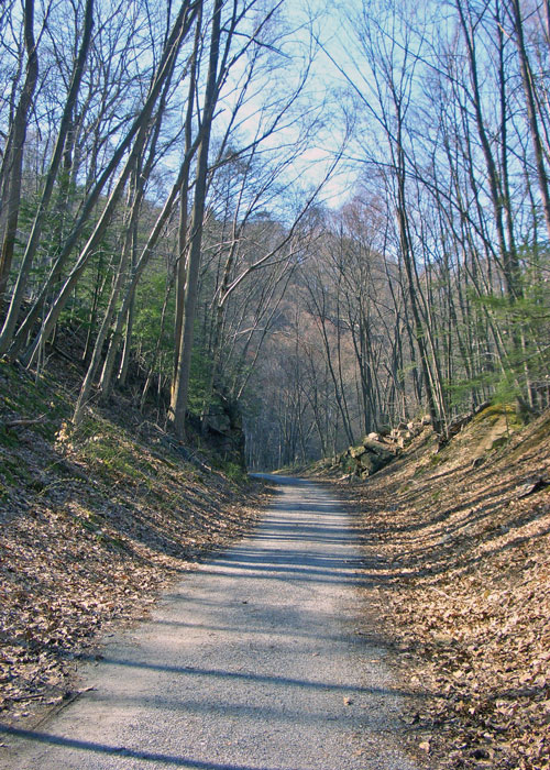
The fifteen mile Columbia Trail in northern Hunterdon County begins in High Bridge, winds through the Ken Lockwood Gorge, the Town of Califon and ends in Long Valley, never straying far from the South Branch of the Raritan River. It is a wonderful ride for cyclists of all ages and abilities. Since my girlfriend and I were riding to enjoy nature and relax, not for an aerobic workout, we aren't too concerned about getting an early start, and we set out around 10am on a Saturday morning. The Columbia Trail fits the bill perfectly since if follows the bed of a former railroad and has little elevation change. It's a nice easy ride to take in the sights.

After making a couple final adjustments to our bikes and helmets and pedaling the few short blocks through High Bridge, we enter the Ken Lockwood Gorge and get underway. It doesn't take long to see why so many people adore the Gorge, a 445 acre Wildlife Management Area that flanks the South Branch of the Raritan River, and the Columbia Trail, for two-and-a-half miles. In some places the trail cuts through the hills, making you feel cradled by the landscape. Other spots offer dramatic views of the gorge from one-hundred feet above the water.
In the first mile, we catch glimpses of Lake Solitude through the trees. If you enjoy waterfalls, the Lake Solitude Dam is a short bike ride down River Road. The Taylor Steel Workers Historic Greenway (hiking or mountain biking only) also splits off of the Columbia Trail, closer to the lake and five other historic sites in High Bridge. A bit past one mile we stop to read the historical marker at the Gorge Bridge over the South Branch. I'm usually not excited by historical markers, but care has been taken to make the collapse of the train trestle in 1885 seem as dramatic as possible. My favorite line is: "The 26 year old tried desperately to apply the brakes on his freight car to stop the train, but it was too late and in an instant, rode the freight car to his deathÉ His watch had stopped at the time of the accident: 10:05 A.M." I give a little squeeze on my brake lever.
The trail continues on for another four miles, and, to get nearer to the water, we take the River Road adjacent to the trail. One lane wide and closed to through traffic for a few jaw-dropping miles in the gorge, it's a popular spot for fly fishermen, whose smooth, repetitive flick of the rods has a curious calming effect and adds to the almost church-quiet ambiance of the cool steep walls and glistening water. Approaching Califon, there is so little car traffic that residents seem to claim the road as part of their front yards, placing hammocks, Adirondack chairs and rope swings in the twenty-foot space between the road and the river.
About five-and-a-half miles from our start, we come to Califon Borough, reportedly home to 170 Nationally Registered Historic Places. We head across the bridge and up Route 512 to the Califon General Store where you can get a full breakfast or a great sandwich and use their air pump. Back down the hill to Califon and on the Columbia Trail again, the river calms downs and flattens out. The homes become sparse and we pass someone taking a draft horse for a ride.
Just north of Califon, we get a surprise. There are a few geocaching nooks along the trail, where you use GPS to find containers—or caches—hidden in public places. When you locate it, you take a small memento from the cache and replace it with something you brought—tiny toys, shells, souvenirs and the like. This particular geocache is labeled the Gnome Home. The stump next to the lawn gnome has a small hole which rotted into it, complete with a door on leather hinges, a latch, electric doorbell, fake flower and pet turtle. The signs instructs that you take anything, but not the gnome! Later, a quick online search revealed that we saw only one or two of the many gnome homes along the Columbia Trail.
Back near the Gorge Bridge we had passed a circle of logs on end with branches balanced between them in a network, and small rocks carefully stacked on each branch. On later visits, I've noticed that the branches are constantly shifting and being added to. At one point the logs had button eyes and ferns for hair. Between the visit to the General Store, the gnome homes, the interesting assortment of branches, and the omnipresent beauty of the river, I'm starting to feel warm and fuzzy about this area. Maybe someday I'll park my bike here for good!
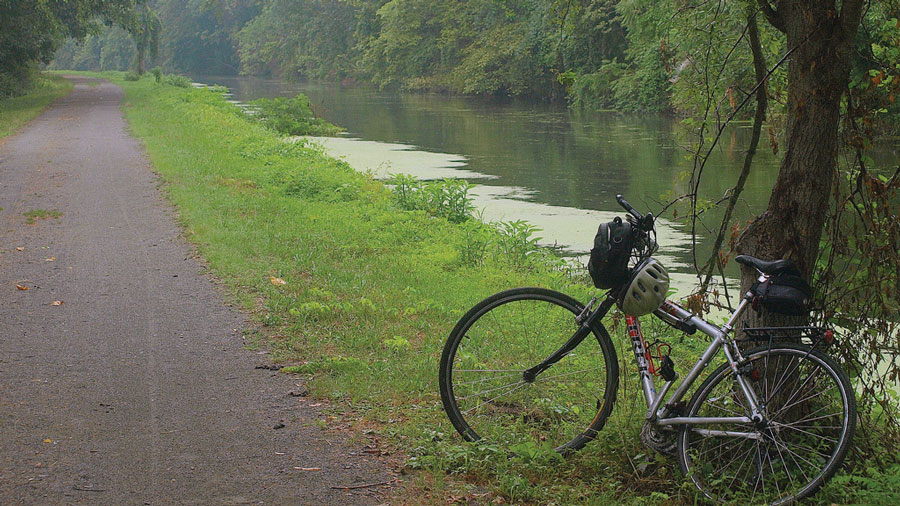
Many people know about the Delaware and Raritan Canal State Park Towpath, with its seventy miles of off-road packed gravel running through numerous towns along the Delaware and Raritan Rivers. In Hunterdon, the towpath follows the old D&R Feeder Canal for twenty miles along the Delaware River, where mules and horses pulled boats up and down the canal. It is a flat route, good for the whole family and provides beautiful views of the expansive river and the tranquil canal. The towns along the towpath—Lambertville, Stockton and Frenchtown—cater to tourists without losing their identity or history. At several points along your ride, you can stop in one of these charming towns for a bite to eat or to soak up the local small town culture.
Round Valley Roundabout weaves along the edge of the Round Valley Reservoir and surrounding forests for 29 miles. Don't let the name fool you, the reservoir is visible for only about two of those miles. The ride is laid out so that it starts in Whitehouse, loops around the south and west shores of the impoundment, then scoots, mostly uphill, on Cokesbury Road to Mountainville. The highlight for me was Rockaway Road which proffered beautiful views of Rockaway Creek's water slaloming between rocks and boulders, as we headed from Mountainville to Oldwick. The road, built back when proximity to water was crucial for farms, squeezes past some beautiful old stone houses and estates. Past Oldwick, the ride gets pretty hectic near I-78, when the road shoulders narrow heading back towards Whitehouse Station.
The Lamington River Ride is short at seven miles, but has some fun curves. The banks of the Black River are lush and the farm at Vliettown Road couldn't be more picturesque: rolling green hills, cows, a red barn with grain silos surrounded by an aged wooden fence. A real picture postcard of Hunterdon County.
The Last Covered Bridge Ride covers more Hunterdon farm country than any of the other routes. After the route starts in Ringoes, you won't see an actual town until you skirt the edge of Hopewell 24 miles away and Princeton six miles further. You'll simply enjoy the mile upon mile of farm fields, broken up occasionally by forest. For the most part, traffic along the way is not a concern, and, if the rare vehicle does pass, you can see it a quarter mile away. There are a few significant inclines (1650 ft. total elevation gain), and for those who can't easily knock out a hilly 48 mile ride, there are two shorter loops of twenty and eleven miles.
If you do the full 48 miles, about twelve of those are in the Sourland Mountain Reservation, a 4,000 acre area through an old, quiet forest that merits its own exploration on bike and on foot. It's the largest protected area for 45 minutes in any direction and provides a cool shaded respite from the open farm fields.

And of course, there is the Last Covered Bridge itself, so named because it is the only remaining one of those in New Jersey. The nearby Wickecheoke Creek sparkles with small rapids and boulders within its steep banks. On Lower Creek Road, I met an older gentleman carefully taking photos of the creek. He had just retired and finished a tour of the national parks in the southwest. He implored me to not wait until retirement to travel and see amazing things. "Do it when you're young and while you can enjoy it properly."
HART Commuter Services is a nonprofit transportation management association that promotes all forms of sustainable transportation to those who live, work, or play in Hunterdon County. Like several similar groups around New Jersey, the organization promotes car and van pooling, distributes schedules and information on available public transportation options, provides traffic alerts to commuters, and advocates for bicycling and walking. These programs have been complemented with a website designed to showcase Hunterdon as a premier cycling destination. The site features route maps, photos and descriptions of five bicycle tours, including four official Department of Transportation (NJDOT) designated routes, plus the Columbia Trail. There are also printable maps and directions, feedback on the various rides, and an interactive Google map showing nearby amenities like parking, food, lodging, historical sites, parks and bike shops.

Delightful fantasies beyond words! Gold, Platinum & Silver Jewelry, Wildlife Photos, Crystal, Lighthouses. Perfume Bottles, Santas, Witches Balls, Oil Lamps, Paperweights, Chimes, Art Glass, Wishing Stars. Also offering jewelry and watch repair

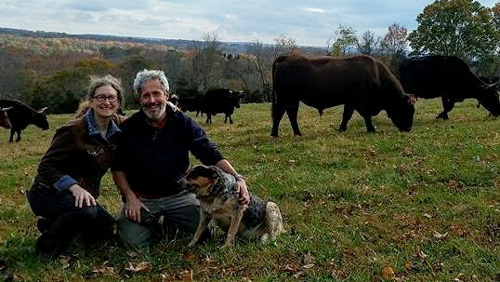
Artisanal cheeses, wood fired breads, 100% grass-fed beef, whey fed pork, and suckled veal, 100% grass-fed ice cream, pasta made with Emmer wheat and our own free-range eggs, and pesto made with our own basil! Bread and cheesemaking workshops are held on the working farm as well as weekend tours and occasional concerts.