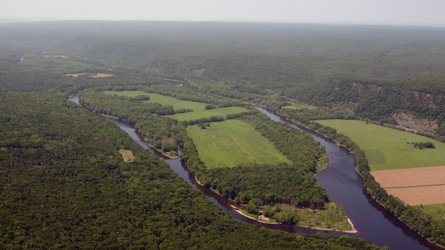
The main stem of the Delaware, 331 miles from Hancock, New York, to its mouth at Cape May Point, New Jersey, is the longest free-flowing river in Eastern United States. Although it drains only 1% of the nation's land mass (13,000 square miles), the river supplies water to 10% of the American population: 700 million gallons of water every day for over twenty million people. Though the human population in the river basin is larger than that of forty states, the Delaware supports an astounding array of wildlife and supports the largest winter populations of bald and golden eagles in the East. Along the way, the islands of the Delaware are markers for the miles traversed on a float down the river, and for centuries of human history along its banks.
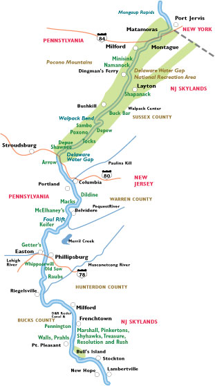
The first stretch of river on our trip begins at the Interstate 84 bridge near Port Jervis, New York, and Matamoras, Pennsylvania, near the confluence of the Neversink and Delaware rivers at Carpenter's Point. Here Tri State Rock marks the intersection of New Jersey, New York, and Pennsylvania. Two miles down stream, past Symmes Islands, lies one of the river's largest islands, Mashipacong, nearly two and a half miles long. You are best to steer clear of the Jersey side, where the river passes through a very shallow channel called a Bena Kill, a vintage colloquialism derived from binnie kill, meaning "minnow stream".
The Delaware Water Gap National Recreation Area begins below Punkys Island, a smaller island between Mashipacong and the Pennsylvania shore near Punkys Rift. River camping is allowed at designated National Park Service sites on many of the islands but is limited to watercraft traveling from one river access to another when the distance between those points is too great to be covered in one day. Campers can stay only one night at each area.
Quicks Island, less than a mile past Mashipacong, bears the family name of Tom Quick, known as the "Avenger of the Delaware." During both the French & Indian War and the Revolutionary War, Tom was a noted Indian fighter who allegedly dispatched many Indians, his revenge for his father's death by their hands.
Just upriver from the Milford-Montague bridge is the Milford river access, and then, about a mile below the bridge is two-mile-long Minisink Island, another of the river's largest islands. The name "Minisink" reflects the Lenape Indian name for an extensive area of which the island is only a small part. Some interpretations of the name are "stony ground" or "place where stones are". Long before the earliest Europeans arrived here, the Lenape had formed a large village, possibly stockaded, on the New Jersey shore across from the island's southern end. Based on the proliferation of ancient Indian trails that led there, it was likely a principal settlement, probably a council village or "capital". The famous Minisink Trail started here and led all the way to the Atlantic coast where the Indians collected shellfish.
Dutch settlers of the late 1600s befriended the Lenape and built a settlement of their own nearby on the New Jersey shore, historically referred to as Minisink Village. By the mid-1700s, relations between the Lenape and Europeans had deteriorated enough that the latter felt the need to build a fortification to protect themselves from Indian attacks. Between the larger Minisink Island and the Jersey shore is Everitts Island.
Half a mile down river from Minisink is one-mile-long Nomanock Island, also used by the Lenape for fishing and possibly a workshop area for making stone tools and weapons. On the eastern shore across from the island and a few hundred yards inland stood Fort Nomanock (or Namanock) built for protection from Indian attack during the French-Indian War. Around that time a few Europeans lived on the island.
A mile down river is Dingman's Ferry Bridge, and three miles below that, half-mile long Shapanack Island (sometimes spelled Shapnack, really a peninsula that gets cut off from the Pennsylvania side when the water gets high) which shares the name of Shapanack Flats close by along the Jersey bank. The flats hosted large Indian villages for hundreds of years before the first European settlers set foot in the area. Across the flats from the island is the historic Van Campen's Inn built prior to 1750 and the site of Fort Shapnack or Fort Johns, the headquarters and supply point for all the forts constructed on the east side of the river during the French-Indian War.
On the Pennsylvania shore three miles below Shapanack is the Eshback access which is small, unpaved, and for canoe or kayak only. A mile below Eshback is the Buck Bar, a small gravelly island. The adjacent long, fertile, flat bottom land and flood plain on the Jersey side held more large Indian villages, as well another fortified structure built during the French-Indian War known then as "Dingman's" or "No. 2" in which nine soldiers were garrisoned.
A small but sharp bend in the river called "Fiddlers Elbow" is located about a half mile downstream from the Buck Bar at the mouth of Tom's Creek on the west side of the water. Then nearly three miles below Eshback, the Bushkill has a large parking area and good boat ramp. Across the river on the Jersey shore was the former Rosenkranz Ferry.
A mile more, near the mouth of Bushkill Creek in Pennsylvania, the Walpack Bend begins. Deflected by high, rocky ridges, the river reverses direction so completely that New Jersey lies west of Pennsylvania until the water resumes its normal southerly flow about a mile and a half from the start of the bend. This is where the waters of the Big Flatbrook enter from New Jersey, sometimes creating great swirling pools in the Delaware that at high water have been said to suck in large pieces of timber, carrying them out of sight. For at least 250 years this area has been called "Walpack", derived from an Indian term roughly meaning "whirlpool". The small island near the end of Flatbrook bend is called Sambo Island, and the adjacent Sambo Rift has been known to give canoers and kayakers exciting rides.
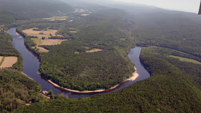
Two miles farther, Depew Island bears the name of one of the area's oldest families and should not be confused with Depui Island six miles farther down the river. The many trees lying horizontally on the island are clues to the devastation of past years' flooding that also prompted the closing of the Depew Recreation Area just south of the island.
A mile and a half below Depew is the fairly large Poxono Island. Known a century ago as Opoxono, the island was large enough to be broken up into at least four tracts and was used for grazing cattle. During the winter, when the river is frozen farther north, this is a good place to sit and wait for eagles. During warmer weather, carp roil the water along the island's edge. The island is near the southern end of Pahaquarry Flat, another area of intense Indian habitation and activity. On the Jersey side just down river from the southern end of the island is the Poxono river access, which has a good ramp and a small parking area off of Old Mine Road.
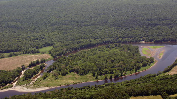
Three miles below Poxono the river passes by a seemingly insignificant narrow island only half mile in length. This is Tocks Island, where plans to construct a huge earthen dam spanning the Delaware near the island's southern end, created much turmoil in the 1960s. In the end the project was abandoned, but not before dozens of people were displaced and their homes razed. Had the dam been built the river's level would have been raised to the 432-foot contour on a USGS topographic map, more than 100 feet above the heads of today's kayakers and canoeists.
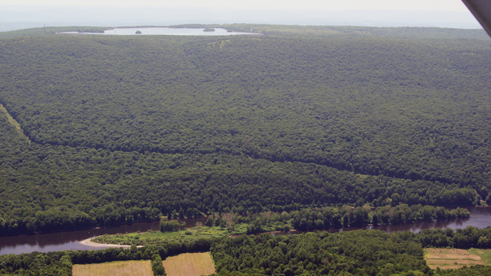
Half a mile below Tocks, Labar Island bears the name of another of the oldest families in the area. Then Woodcock Bar appears on some topographic maps as a series of small islands below Labar.
Less than half a mile downstream is Depui or Depue Island, once known as Manwalamink, which was owned and vigorously cultivated by the Depui family who raised immense crops of grain and hay here from 1725 up to 1898. On the island was an old Indian Council Tree whose diameter was six feet across when it was struck and killed by lightning well over a century ago. Directly south of this tree was an Indian burying ground.
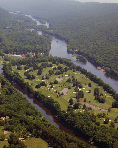
Depui Island is the upper of two islands purchased in 1898 by Charles C. Worthington, a wealthy industrialist whose extensive estate covered both sides of the river. A quarter mile below Depui is Shawnee Island, which Worthington developed into one of the nation's most attractive golf courses of the time, host to many tournaments and celebrities.
After passing by the ruins of an old railroad bridge the river continues past Schellenberger Island a quarter mile below Shawnee. Over the years flooding has cut the island into a few smaller sections. The southern edge was once home to Island Park, which offered swimming in the river, a giant slide, merry-go-round, camping, and a food tent or pavilion with tables for picnicking. Flooding in 1936 destroyed the park.
Arrow Island, named for its shape, is the first island past the Water Gap down river from the I-80 bridge and marks the southern end of the Recreation Area. During the 1800s many rafts were driven onto the island due to the frequent high winds through the Water Gap. Seven miles down river are Attins and Thomas Islands, which at one time were probably all one island. Over the years they have been known by various names and have been mislabeled on various maps. The Atten family settled here in the early 1700s and probably ran a ferry in 1783.
Incorrectly labeled "Thomas Island" on some maps, Dildine Island is less than a half-mile down river from Attin's Island, near King Cole's grove on New Jersey Route 46. The Manunka Chunk House, a large resort, was once located on the island, accessed by horse & carriage when the river was low enough to ford, or by ferry when it was higher. Down river from Dildine is Mack's Island and farther yet is Buttermilk Island, which "disappears" when the river rises.
McElhaney's Island, also known as Butternut Island, is nearly against the Pennsylvania shore preceding the Belvidere-Riverton Bridge. Once a popular swimming and beach area, usage dropped after a drowning precipitated the construction of the Belvidere swimming pool as an alternative to bathing in the river.
Down river from the Belvidere-Riverton bridge, below the very dangerous Foul Rift, and beyond Mason's Island, is Keifer's Island, claimed to have once been part of the mainland but since separated by a flood. The river continues past the "sand beach" on the Pennsylvania side, an area once popular for bathing, then at Sandt's Eddy, a couple of miles past Keifer's Island, is a good river access with paved ramp. Beyond that the river flows through Weygadt Gap, called by raftsmen of long ago the "Little Water Gap".
The Pot Rock, along the western shore just north of the Easton water pumping station, is not really an island and is so named for the few dozen potholes that the forces of nature have carved into it. For many years it was believed that Indians had laboriously carved out these holes for use as mortars in which to grind corn. Raftsmen of the 1800s tied their rafts off at the eddy here.
A quarter mile above the Route 22 bridge connecting Easton & Phillipsburg is Getter's Island, noted for two unfortunate events. In 1833 Charles Getter was hanged on this island for the murder of his wife, the last public hanging in Pennsylvania. In 1860, during an attempt to establish steamboat service on the Delaware, the Alfred Thomas blew up near the northern end of the island, killing nearly two dozen passengers.
A short distance past the I-78 bridge is an unnamed island, followed by Whippoorwill Island a mile and a half down river from the bridge, so named for the birds it has harbored in the past. For reasons unknown the island a half-mile below Whippoorwill has been called Old Sow Island for at least 150 years. Raftsmen of the 1800s knew it as Cross Water Island due to the strong currents at the end of the island. The sudden jolt of the currents would sometimes catch the raft's forward oarsmen by surprise and throw them into the water.
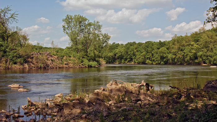
One mile below Old Sow is Raub's Island, named for one of the early families in the area and who used the island as pasture for their cattle. On the island is a stone and iron pylon that was once part of a cross-river tramway transporting goods from a long gone paper company on the Pennsylvania side to the railway stop in New Jersey. The river along the island's eastern side, from the mouth of the Pohatcong Creek to the southern end of the island, generates a series of seemingly docile small whirlpools that can be very dangerous at times. Strong down currents can pull down even seasoned swimmers, and canoes and kayaks can be spun around despite ostensibly calm waters. The most recent drowning here was in 2006. Stay in your boat!!
The Riegelsville bridge spans the water two and a half miles past Raubs Island, then it's nearly another two to Lynn's Island where there is a good chance you'll spot a bald eagle. The river flows another eight miles islandless, under the Milford bridge and on to Frenchtown, where, just beyond that bridge, Pennington Island hugs the Pennsylvania shore. Then Marshall Island runs two miles down the middle of the river. A large clump of islands follows for another two miles, a maze of channels between them ripe for exploration: Pinkertons, Shyhawks, Treasure, Resolution and Rush. Treasure Island is home to one of the oldest Boy Scout Camps in America, operating since 1913.
Finally, approaching Point Pleasant, Pennsylvania, Walls and Prahls Islands situate themselves consecutively with a slight bias toward the Pennsylvania line. Canoeists choosing the narrower channel to the starboard look forward to moderately challenging rapids below Walls. Or if you choose to cut between the islands back to the Jersey side you'll be presented with wider, but fast, water.
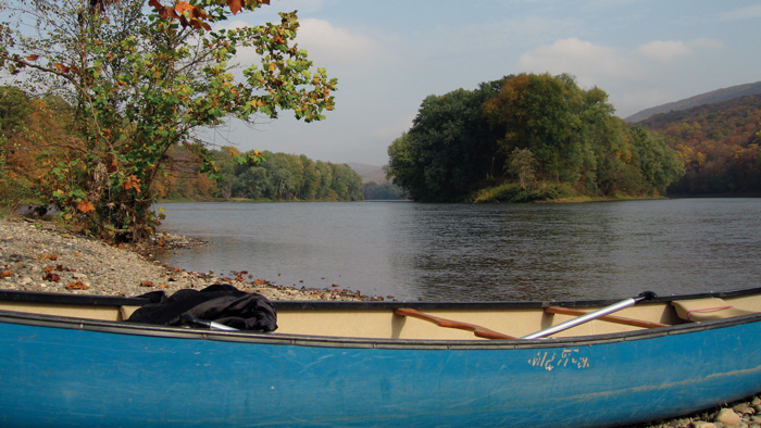
Knowing the river-its beauty, history, and its hazards-can provide you and your family with many days of enjoyment this summer. If possible, plan your trip for a weekday, and you'll feel like you have the river all to yourself. Liveries run by seasoned professionals along both the New Jersey and Pennsylvania banks, can assure you of a safe trip with consistently up-dated equipment, the convenience of shuttles from end to end, and words of advice that will make your trip the best it can be.
If you bring your own watercraft, you will need to decide which river accesses to use for entry and exiting from the water. Make sure to use the most recent maps, since many changes have taken place over the past years due to flooding, funding, and other reasons.
The river is not always tame, so be certain to do your homework and that you have the skills necessary to negotiate some of most challenging sections such as Foul Rift below Belvidere or the areas with dams such as those at Bull's Island or Lambertville. River sojourners consistently recommend Canoeing the Delaware River by Gary Letcher as a reliable guide.